
Updated : January 2020
Here are some useful websites for weather relating to Fiji.
Put these into your Favourites/Bookmarks in your browser and they’ll always be there.
Joint Typhoon Warning Center (JTWC)
http://www.usno.navy.mil/JTWC/
Located at Naval Base Pearl Harbour, Hawaii, the Joint Typhoon Warning Center (JTWC) is the U. S. Department of Defense agency responsible for issuing tropical cyclone warnings for the Pacific and Indian Oceans.
Lots of good, fast loading, easy to read graphics, along with a good amount of information about strike probability and strength.
PDC Atlas
http://www.pdc.org/atlas/
Pacific Disaster Center’s Natural Hazards and Vulnerabilities Atlas is a powerful decision support application for disaster management and humanitarian assistance organisations around the world.
Governments and organisations charged with disaster management are seeking innovative and comprehensive decision support systems, as well as better information and easier access to information about past, present and potential disasters. PDC’s Atlases answer these needs.
The Atlases contain information on major hazards, both “active” and “historical” including tropical cyclones, earthquakes, tsunamis, volcanoes, floods, and wildfires. They provide decision makers with the needed geospatial context for assessing risks and communicating about natural hazards and the exposure that people and infrastructure have to these hazards. The Atlases support activities across the disaster management cycle including hazard assessment, early warning, and response and recovery operations.
Tropical Storm Risk (TSR)
http://www.tropicalstormrisk.com/
Tropical Storm Risk (TSR) offers a leading resource for predicting and mapping tropical storm activity worldwide.
The public TSR web site provides forecasts and information to benefit basic risk awareness and decision making from tropical storms. The new TSR Business service and web site offers real-time products of unrivalled accuracy for the detailed mapping and prediction of tropical storm impacts worldwide. TSR has won two major insurance industry awards – the British Insurance Awards for Risk Management (2006) and for London Market Innovation (2004).
Pacific Disaster Center (PDC)
http://www.pdc.org
Pacific Disaster Center (PDC) is an applied science, information and technology center, working to reduce disaster risks and impacts to peoples’ lives and property.
PDC works to foster disaster resiliency through the use of science, information, and technology for sound, evidence-based decision making. PDC is an applied research and development, public-private enterprise promoting a disaster risk reduction (DRR) agenda and concepts by bridging the divide between the scientific communities and the disaster management professionals.
PDC Weather Wall: Weather and Disaster News
http://weather.pdc.org/
Pacific Disaster Center (PDC), Kihei, HI 96753
HurricaneZone.net
http://www.hurricanezone.net/
HurricaneZone.net is Jonathan Edwards’s web site dedicated to following tropical cyclones around the world. Jonathan Edwards has been developing hurricane-related web sites since 1995.
HurricaneZone.net continues in the tradition of the Hurricane Resource Center, the Tropical Cyclone Pages, Taifun.org, and SuperTyphoon.
HurricaneZone.net provides access to numerous Internet-based resources originating from government, education, and private industry. HurricaneZone.net facilitates the acquisition of timely information about the development and progress of tropical cyclones world wide.
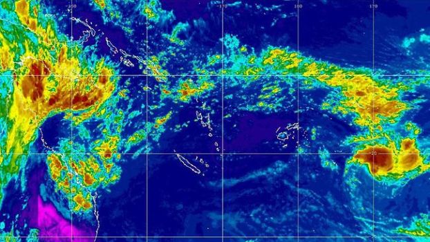
NOAA’s South Pacific Satellite Images and Loops
http://www.goes.noaa.gov/sohemi/
The National Weather Service is a component of the National Oceanic and Atmospheric Administration (NOAA). NOAA is an Operating Unit of the U.S. Department of Commerce.
Fiji is in the “MTSAT East” Sector
MTSAT IR Colorized Loop: http://www.goes.noaa.gov/sohemi/sohemiloops/shirgmscol.html
Fiji Satellite loop: http://www.goes.noaa.gov/sohemi/sohemiloops/shfiji.html
Currently Active Tropical Cyclones
The Regional and Mesoscale Meteorology Branch (RAMMB) of NOAA/NESDIS conducts research on the use of satellite data to improve analysis, forecasts and warnings for regional and mesoscale meteorological events.
http://rammb.cira.colostate.edu/products/tc_realtime/index.asp
Other Weather Sites
Fiji Meteorological Service (FMS)
http://www.met.gov.fj/
The Fiji Meteorological Service (FMS) functions as a Department under the Government of Fiji Islands and has the responsibility to provide an essential service to the country. It also serves on a regional scale providing weather forecasting and tropical cyclone warning services to many other countries and a vast area of the tropical South-west Pacific. Fiji Meteorological Service Headquarters in Namaka, Nadi Airport.
MetVUW.com
http://www.metvuw.com/forecast/forecast.php?type=rain&region=swp&noofdays=7
These weather forecast charts are generated by software written and maintained by James McGregor.
Chart plotting is powered by Generic Mapping Tools (GMT). The data used is obtained from the United States National Weather Service. These charts are updated approximately every 6 hours and provide forecasts up to 180h ahead of the time they were issued.
It takes six hours to generate all the forecasts and so the issue time should be between 6-12 hours behind the current time. If this is not the case try pressing the “refresh” button on your browser.
Nadraki
http://www.nadraki.com/
Nadraki provides expert weather and climate consultative services to business, industry, government and non-government organizations and the community in Fiji.
Buoyweather.com
http://www.buoyweather.com/wxnav6.jsp?region=fiji&program=Maps
PDC Weather Wall
Web accessible page: http://www.pdc.org/weather/
Read our daily coverage of worldwide tropical cyclone activity, severe weather, and
hazard information. Learn More »
Tsunamis
Pacific Tsunami Warning Center
http://ptwc.weather.gov/?region=1
As the primary operational headquarters for the Pacific Tsunami Warning System, PTWC provides warnings for Pacific basin teletsunamis (tsunamis that can cause damage far away from their source) to almost every country around the Pacific rim and to most of the Pacific island states.
This function is carried out under the auspices of the UNESCO/IOCInternational Coordination Group for the Pacific Tsunami Warning System.
PDC Atlas
http://www.pdc.org/atlas/
Pacific Disaster Center’s Natural Hazards and Vulnerabilities Atlas is a powerful decision support application for disaster management and humanitarian assistance organisations around the world.
Pacific Disaster Center (PDC), Kihei, HI 96753
Pacific Disaster Center (PDC)
http://www.pdc.org
Pacific Disaster Center (PDC) is an applied science, information and technology center, working to reduce disaster risks and impacts to peoples’ lives and property.
PDC works to foster disaster resiliency through the use of science, information, and technology for sound, evidence-based decision making. PDC is an applied research and development, public-private enterprise promoting a disaster risk reduction (DRR) agenda and concepts by bridging the divide between the scientific communities and the disaster management professionals
PDC Disaster Alert
Download this app for iOS or Android and receive multi-hazard information on your mobile devices. Disaster Alert provides information from trusted sources around the globe on current incidents that are potentially hazardous to people, property, or assets.
http://www.pdc.org/solutions/tools/global-hazards-atlas
Web accessible page: https://disasteralert.pdc.org/disasteralert/
Mobile Apps
Disaster Alert for iOS 6 and Android
http://www.pdc.org/iweb/disasteralert.jsp
PDC has released a new version of its popular Disaster Alert, a free-download application (“app”) for iPhone, iPad, and Android devices that provides users with

instant access to worldwide hazards information. The app informs users of active hazards around the globe —current and near-real time incidents that are designated “potentially hazardous to people, property, or assets”—via maps and lists, with links to other useful information about the events and their potential impacts.
The update was heavily influenced by user feedback, a top priority when PDC develops new versions. “The number one user requested feature was push notification, so this was our primary goal for this release,” says PDC Executive Director Ray Shirkhodai. “We are constantly enhancing our applications and improving the timing, accuracy, and breadth of hazard information, based on real user feedback.”
The active hazards are detected by the Center’s DisasterAWARE platform which continuously “listens” to authoritative sources for various hazards and incidents, and issues notifications when a potential hazard is observed.
These active hazards and all incidents may also be viewed via the Internet in PDC’s Global Atlas, as well as on Facebook and Twitter. Disaster Alert provides a quick access to the hazard information via popular mobile devices.

iGDACS provides near real-time information about natural disasters and gives the possibility to send back information in the form of a geo-located image and/or text.
The Global Disaster Alert and Coordination System (GDACS) is a cooperation framework between the United Nations, the European Commission and disaster managers worldwide to improve alerts and information exchange.

iGDACS is intended to tap the abundant information about disasters available from people who actually experience them. Reports of the iGDACS users are used to improve the overall situational picture.
The iGDACS iPhone App provides users real-time information about disasters (GDACS Alerts) and gives them the possibility to send information in the form of a geo-located image and/or text back.
Targeted users include professional emergency responders of tGADSC, as well as general users affected by disasters.
The App intended to tap the abundant information about disasters available from people who actually experience them. Reports of the iGDACS users are used to improve the overall situational picture.

Pacific Ocean Tsunami Alerter
https://play.google.com/store/apps/details?id=com.spacenext.tsunami.pacificocean&hl=en
Receive Tsunami Alerts for Pacific Ocean instantly on your Android. It gets the feed from PTWC.
Content Credits: All information above have been kindly supplied by FHTA Associate Member, Mr Stuart Gow of Resort Support


